

How survey data supports mine rehabilitation from design through to long-term monitoring.
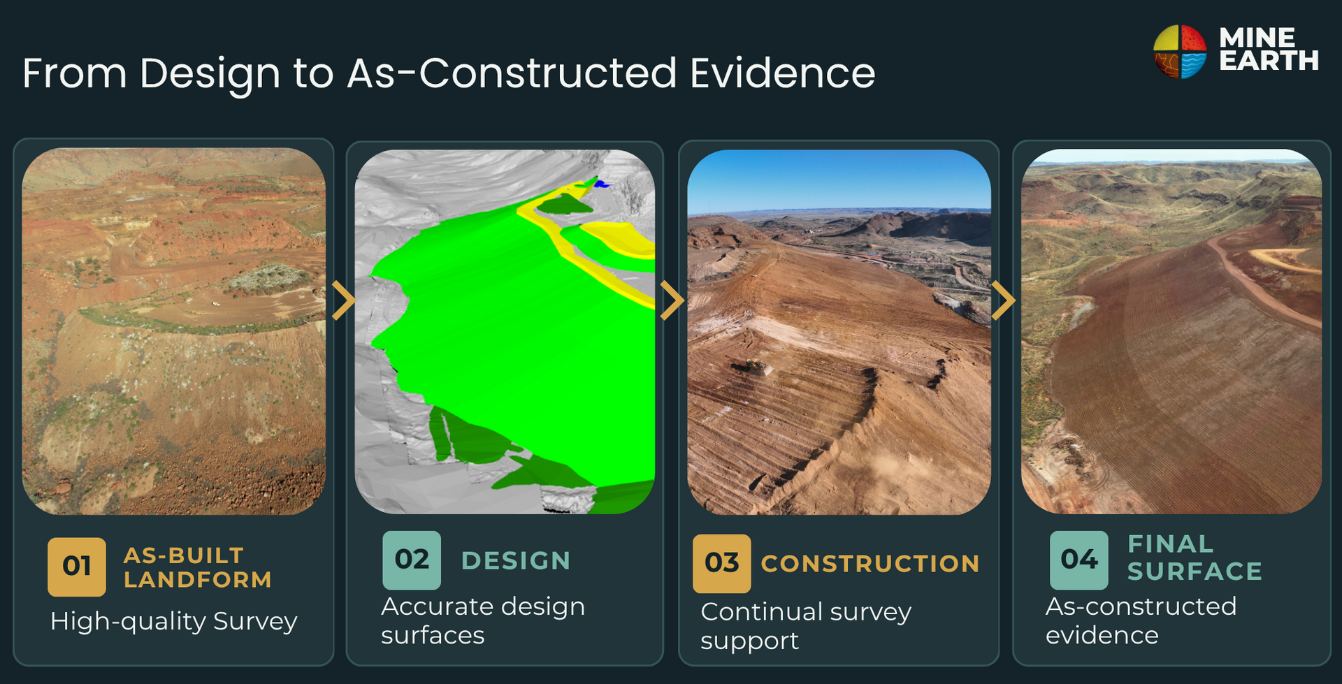
High-quality survey (geospatial) data is fundamental to successful mine rehabilitation. It underpins every stage of a project - from planning and design through to construction delivery and long-term performance monitoring.
One of the most common gaps encountered across rehabilitation projects is the absence of reliable survey data and/or sufficient on-site survey capability. When these gaps exist, risks can emerge early and compound over time - impacting design accuracy, construction efficiency, and ultimately rehabilitation outcomes.
Planning and Design: Starting with the Right Data
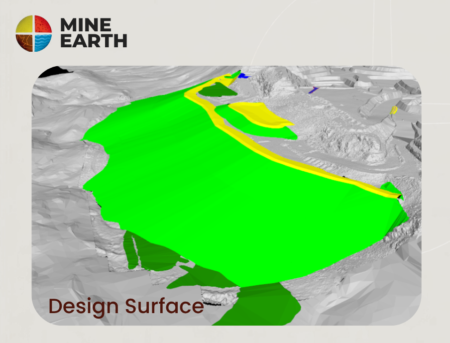
A rehabilitation design cannot be developed without accurate, up-to-date survey data. Landform designs rely on a clear understanding of current site conditions, including the landform itself and the surrounding environment.
If designs are developed from poor-quality or outdated data, errors can be introduced into final landform geometry and cut-to-fill balances. These issues often result in increased costs, rework, and challenges during construction.
Common challenges include:
- Designs based on outdated or “tip-to” surfaces rather than current as-constructed conditions
- Erroneous or incomplete datasets
- Limited historic survey coverage
- Unaccounted material settlement in a landform over time
Without accurate, up-to-date data, risks emerge early and compound across construction and long-term performance
Establishing a strong survey data foundation at the outset is essential to developing practical and constructible rehabilitation designs.
Delivery: Enabling Efficient Construction
During the delivery phase, survey capability plays a critical role in ensuring works are carried out safely, efficiently, and within tolerance. Survey supports:
- Field set-out for landform reshaping
- Marking of cut/toe lines and contour lines
- Pegging depths for rock armour and soil placement
- Setup and calibration of machine control systems
As landform designs become increasingly complex, the need for accurate survey control continues to grow. Proper setup and calibration of GPS-enabled plant is essential to achieving the design intent and maintaining productivity.
Delivery: Quality Assurance and Conformance
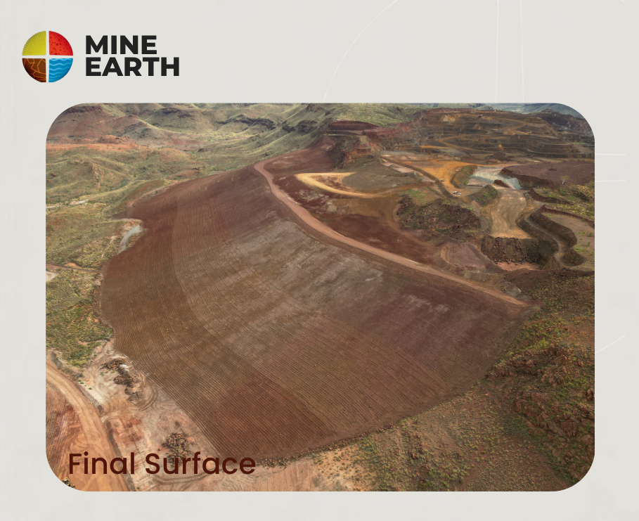
Survey is central to quality control throughout the rehabilitation works program. At key hold points - and at completion - survey data provides the evidence required to demonstrate that:
- Works have been constructed within agreed tolerances, or
- The overall design intent has been achieved
This is critical for demonstrating compliance with closure commitments and ensuring outcomes are defensible to internal and external stakeholders.
Monitoring: Understanding Long-Term Rehabilitation Performance
Survey continues to provide value long after rehabilitation is complete. Modern monitoring techniques are increasingly survey-driven, including:
- LiDAR surveys, which enable detailed, landform-scale assessments of erosion and drainage performance
- Multispectral surveys, which provide insights into vegetation cover, health, density, and canopy structure
These methods allow for consistent, repeatable monitoring across entire landforms - not just sampled areas - supporting early identification of issues and informed decision-making over time.

Survey Equipment and Capability
At Mine Earth, our Geospatial team supports rehabilitation projects with modern survey technologies and experienced personnel.
Our capability includes:
- GNSS survey systems
- Drone-based photogrammetry and LiDAR
- Multispectral data capture and analysis
These tools enable efficient, accurate data capture and support informed decision-making across the full project lifecycle.
Closing Thoughts
Survey is often viewed as a supporting discipline - but for mine rehabilitation, it is a critical contributor to efficient and successful outcomes.
By integrating high-quality survey data throughout design, delivery and monitoring, projects can:
- Reduce risk
- Improve construction efficiency
- Strengthen quality assurance
- Demonstrate closure performance with confidence
Need support with rehabilitation survey and geospatial data?
Mine Earth provides practical geospatial solutions to support rehabilitation from planning and design through to construction, conformance and long-term monitoring.
Related Articles

